Nomadia Geoconcept SIG
The solution for fully leveraging your territorial data
Nomadia Geoconcept GIS allows you to centralize, analyze, and visualize all your geographic data within a single platform.
Thanks to advanced mapping and territorial analysis tools, you can transform your data into a powerful decision-making asset to manage your activities, optimize resources, and identify new opportunities.
Need a quote or have a question?
Leave your contact informations
Accelerate sales performance
Visualize your market potential, identify underserved areas, and optimize your sales coverage. Nomadia Geoconcept GIS helps you balance sales territories, align your goals with on-the-ground reality, and improve conversion rates. Sales leaders gain access to precise geographic insights to drive growth, prioritize initiatives, and maximize revenue
Optimize networks and infrastructure
For utility and energy stakeholders, territorial mastery is strategic. Nomadia Geoconcept GIS maps networks, facilities, and intervention zones to anticipate needs, plan maintenance, and secure operations. With a reliable geospatial vision, you improve service continuity, mitigate field risks, and optimize infrastructure investments.
Drive regional public policy
Public authorities and stakeholders must constantly balance budgetary constraints with citizen needs. Nomadia Geoconcept GIS helps visualize facilities, analyze service coverage, and identify territorial disparities. Public decision-makers gain an objective foundation to prioritize projects, plan infrastructure, and strengthen the effectiveness of public policies.
Master insurance risks
In the insurance industry, geographic data is key to assessing risk exposure and refining pricing. Nomadia Geoconcept GIS allows you to analyze loss ratios by zone, identify risk concentrations, and optimize the deployment of field adjusters. You improve portfolio profitability, accelerate claims management, and strengthen prevention strategies.
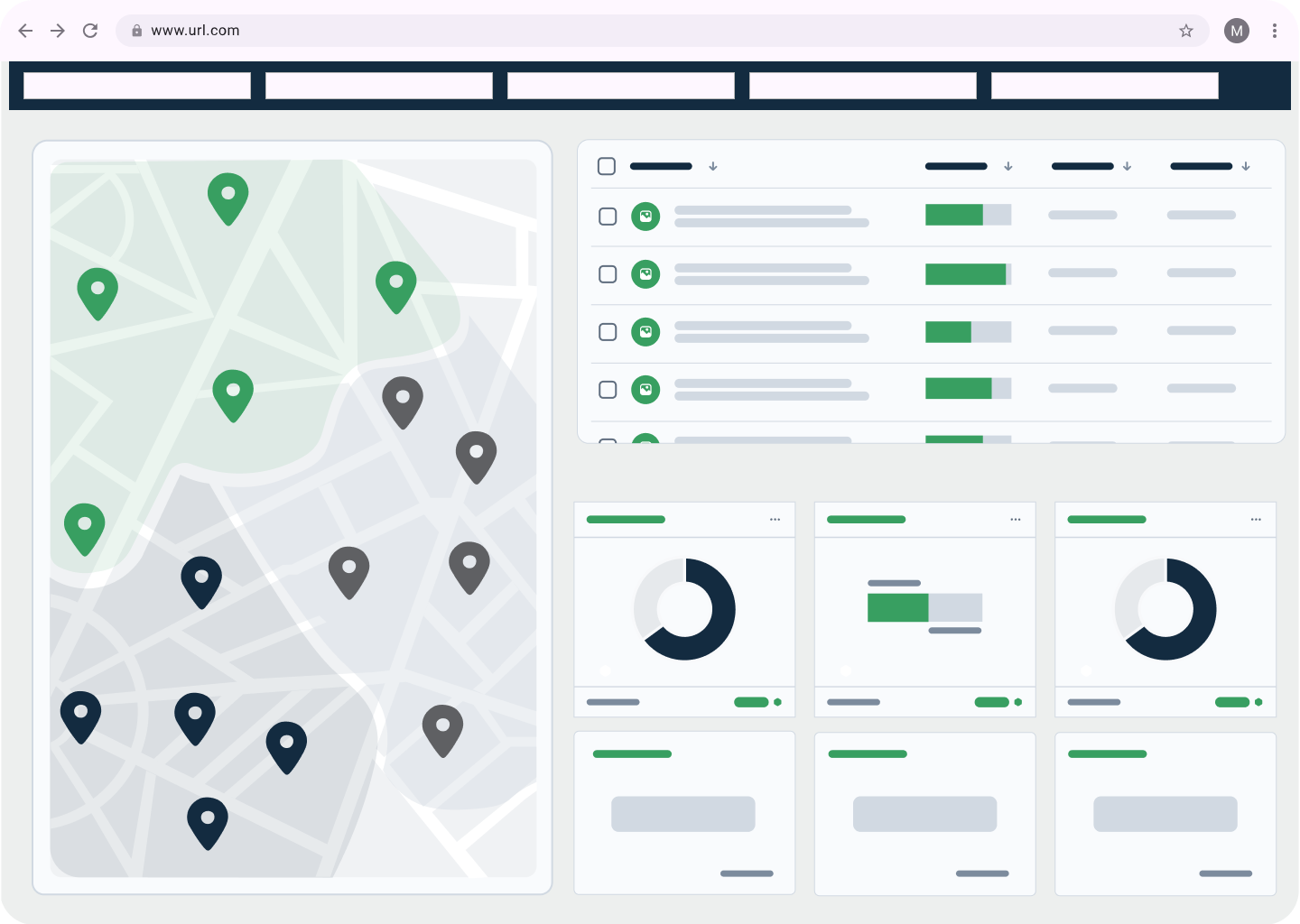
Advanced & dynamic geospatial analytics
Nomadia Geoconcept GIS allows you to cross-reference your business data with enriched map layers to reveal trends invisible to the naked eye. From territorial segmentation and isochrones to density analysis and geographic scoring, you have powerful tools at your disposal to refine sales strategies, anticipate risks, optimize networks, and prioritize field actions with maximum precision.
Measurable ROI and faster decision-making
Nomadia Geoconcept GIS transforms geographic data into concrete business impact. By identifying high-potential areas, reducing unnecessary travel, and optimizing resource allocation, you drive both productivity and profitability. Decision cycles are shortened, investments are better targeted, and every field action contributes directly to the overall performance of the organization.
Drive your decisions with geodata
Public and private organizations are facing an explosion of geographic data: customers, points of sale, field interventions, networks, and infrastructure. Yet, this information often remains underutilized, siloed, or difficult to analyze. In a landscape where territorial performance has become a major competitive advantage, organizations need tools capable of transforming spatial data into concrete decisions. A modern Geographic Information System (GIS) makes it possible to visualize, analyze, and intelligently leverage territories to optimize resources, improve market coverage, and fuel growth.
Leave your contact informations,
We call you back
Key features
-
Interactive layered mapping
-
Advanced territorial analytics
-
Dynamic territory mapping and balancing
-
Integration with your business systems.
-
Reporting and collaborative sharing
Interactive layered mapping
Visualize all your business data on a dynamic mapping interface. Overlay various information layers (customers, infrastructure, risks, performance, socio-demographic data) to get a comprehensive view of the territory. Advanced filters allow you to refine your analysis in real-time and adapt the display to meet your strategic or operational objectives.
Advanced territorial analytics
Leverage powerful geospatial analysis tools: isochrone calculations, density analysis, geographic segmentation, territorial scoring, or market potential studies. These features allow you to identify priority areas, anticipate market trends, and detect imbalances. Make decisions based on concrete, objective data.
Dynamic territory mapping and balancing
Structure and adjust your territories based on workload, market potential, or operational constraints. Nomadia Geoconcept GIS facilitates the creation, simulation, and optimization of balanced sectors. You ensure an equitable distribution of resources, improve field coverage, and provide sustainable support for sales or operational performance.
Integration with your business systems
Connect Nomadia Geoconcept GIS to your CRM, ERP, field service tools, or internal databases. Automatic synchronization ensures the reliability of information and eliminates duplicate data entry. This interoperability makes it possible to integrate the geographic dimension at the heart of your business processes and to share consistent analyses across teams.
Reporting and collaborative sharing
Generate custom maps, geographic dashboards, and exportable reports for your teams or management. Visualizations can be easily shared to align strategic and operational decisions. This helps facilitate collaboration across departments while ensuring a clear and shared understanding of territorial challenges.
They optimize their routes with Nomadia!
Learn from their success stories.
“We provide FDJ agencies with a tailored portfolio optimization service.”
“We decided to find a specialized tool to enable on-demand, multi-criteria portfolio optimization and balancing, allowing us to quickly address the specific needs of each agency.”
Anaïs COMBES
FDJ Project Manager
“Nomadia Geoconcept is a key marketing asset in developing the JCDecaux offering.”
“With quick deployment, user-friendly design, and highly readable support maps, Nomadia Geoconcept solutions continue to meet JCDecaux’s needs.”
Nicolas BONUS
Marketing Department, JCDecaux
“Carglass leverages Nomadia Geoconcept to develop its network and optimize vehicle operations.”
“Over the years, Nomadia Geoconcept has helped us perfect our geomarketing strategy with its high-performance, intuitive, and flexible solutions. Leveraging geographic insights greatly enriches market data analysis and supports strategic decisions for expanding our retail network.”
Christophe VIALA
Competition & Development Manager, Carglass
Any questions left?
Find answers to the most frequently asked questions by our clients.
What is GIS software (Geographic Information System)?
GIS software is a solution used to collect, analyze, and visualize geographic data on a map to support decision-making.
A Geographic Information System (GIS) combines mapping data with business data (customers, points of sale, infrastructure, territories) to perform advanced geospatial analysis.
Nomadia Geoconcept is a GIS software that enables companies to map their data, analyze their territories, and optimize their field strategies.
What are the main use cases for GIS in a business environment?
A GIS software like Nomadia Geoconcept is used across many industries for:
Sales territory mapping (sectorization)
Catchment area analysis
Distribution network optimization
Site selection for new points of sale
Field service planning (intervention scheduling)
Territorial coverage analysis
A GIS thus enables the transformation of geographic data into actionable operational insights.
What types of data can be analyzed with Nomadia Geoconcept?
Nomadia Geoconcept can analyze a wide range of geographic and business data, including:
Customer and prospect data
Points of sale and distribution networks
Demographic and socio-economic data
Mobility and accessibility data
Sales territories
Internal CRM or ERP data
This data can be combined to produce highly accurate geomarketing and territorial analyses.
What are the benefits of a GIS for sales teams?
A GIS like Nomadia Geoconcept helps sales teams to:
Optimize sales territory mapping (sectorization)
Identify new high-potential prospects
Balance team workloads
Analyze sales performance by area
This enhances commercial coverage and boosts the performance of field sales forces.
Can Nomadia Geoconcept integrate with other business tools?
Yes. Nomadia Geoconcept can integrate with numerous information systems:
CRM (Customer Relationship Management)
ERP (Enterprise Resource Planning)
Internal databases
BI and data analytics tools
Field operations management solutions
This integration allows for the use of existing data to enrich geospatial analyses and automate decision-making workflows.
What does Nomadia Geoconcept GIS do?
Nomadia Geoconcept is a GIS solution used to analyze geographic data and optimize strategic and operational decision-making.
Companies use Nomadia Geoconcept to:
Visualize their data on a map
Analyze trade areas
Optimize commercial sectoring
Identify new locations
Plan field operations
Thanks to these geospatial analyses, organizations can make faster, data-driven decisions based on territorial insights.
How does a GIS differ from regular mapping software?
Standard mapping software displays maps, whereas a GIS allows you to analyze and cross-reference complex geographic data.
A GIS like Nomadia Geoconcept enables you to:
Integrate business databases
Perform advanced spatial analyses
Simulate territorial scenarios
Produce decision-making maps
In other words, a GIS is a strategic analysis tool, not just a visualization tool.
Who benefits from using GIS software like Nomadia Geoconcept?
GIS software is used across many professions, including:
Sales departments
Geomarketing teams
Network managers
Urban planners and local authorities
Transport and logistics companies
Field operations teams
Nomadia Geoconcept enables these teams to make decisions based on geospatial analysis.
How can a GIS assist in selecting the best location for a store?
GIS software analyzes multiple geographic factors to identify the best locations:
Population density
Socio-demographic profile
Local competition
Accessibility and traffic flows
Trade areas
With Nomadia Geoconcept, companies can simulate different site scenarios and select the most profitable location.
Why choose Nomadia Geoconcept as your GIS software?
Nomadia Geoconcept is a GIS platform recognized for:
Its geospatial analysis power
Advanced decision-making mapping capabilities
Specialization in business use cases (geomarketing, sectoring, networks)
Integration with the Nomadia ecosystem
The solution enables companies to turn geographic data into concrete operational decisions.
Leave your contact information,
We call you back